Finally … a break in weather
Published 6:00 am Wednesday, February 25, 2004
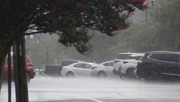
Area officials breathed a sigh of relief Wednesday morning whenheavy rains expected for Tuesday night failed to materialize.
The expected rains would have worsened flooding problems fromnearly three weeks of heavy downfalls in the area.
A recorded .34 inches of rainfall fell in the city, according tothe Brookhaven Waste Water Treatment Plant, and .75 inches ofrainfall in the county, according the Lincoln County Civil DefenseOffice.
Rain damage did force the closure of the Parnell Creek Bridge onBethel Road, said District One Supervisor the Rev. JerryWilson.
Wilson urged caution among motorists. A traveler Monday crashedwhile attempting to circumvent barricades placed to protecttravelers at the bridge. The motorist was not injured, but may havefurther damaged the bridge.
“It’s a bad situation,” Wilson said, referring to the dangersposed by people going around the barricades.
Rainfall may have also contributed to a brief power outage inthe Jayess area Wednesday morning, said a Magnolia Electric PowerAssociation spokesperson.
Power was restored in about half an hour, he said, but he couldnot say how many people were affected by the brief outage.
“It could have been caused by lightning,” he said.
Other areas reported little or no damage resulting fromcontinued rainfall.
“No one has called us today about any roads flooded or otherdamage,” said Cindy Galey of the Lincoln County Civil DefenseOffice.
Robert Patterson, director of the Lawrence County Civil DefenseOffice, agreed.
“(A major thunderstorm) was supposed to be here around 4 a.m.,but we missed it,” he said. “I was up and expecting some calls, butit never hit us.”
Patterson said he also had not received any calls of damage.
The area remains under a flash flood watch until 4 p.m.Wednesday. Rain is expected to last throughout the day.
According to the National Weather Service, the forecast forWednesday and later this week is improving.
“I think the thunderstorms have shifted to the east,” said BradBryant, a forecaster with the NWS.
Bryant predicted widespread rain with isolated thunderstormsWednesday with slight rainfall continuing to develop from thesouth. He said the area may receive another inch of rain, but hedoubted it would be more than that.
By the end of the day, Bryant said, the rains should dissipatewith only a slight chance of rain Thursday.
More Uncategorized


-
Polls
 Loading ...
-
-