Ida to be ‘major incident’ for area
Published 8:10 am Sunday, August 29, 2021
Hurricane Ida will be a major incident for Southwest Mississippi, according to retired Lincoln County Emergency Management Director Clifford Galey.
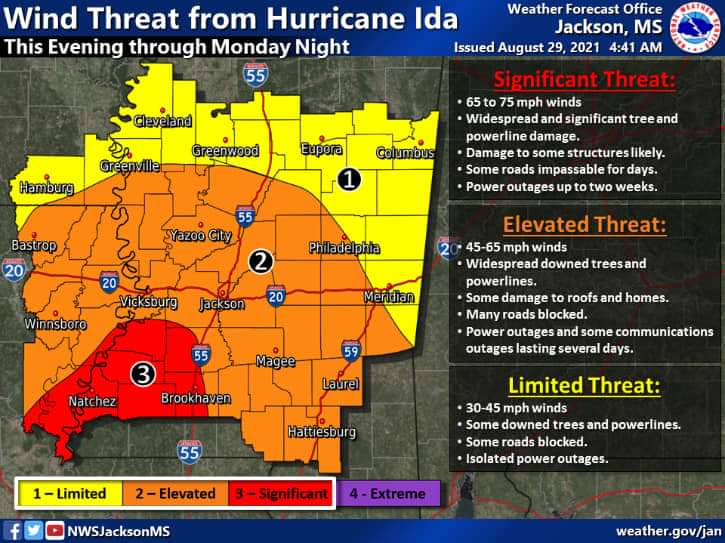
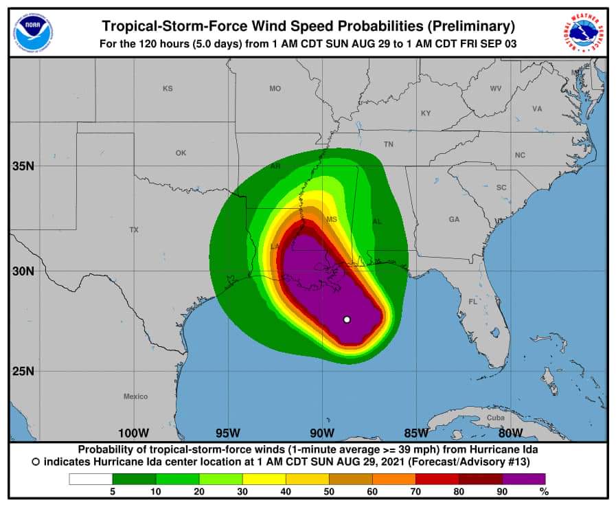
Peak winds of 35 to 45 mph are expected with gusts up to 75 mph from early Sunday afternoon through Monday afternoon, according to the National Weather Service.
“Please stay weather aware and be safe,” Galey said.
NWS said Sunday morning a threat to life and property existed that includes typical forecast uncertainty in track, size and intensity.
“Remaining efforts to protect life and property should be completed as soon as possible. Prepare for significant wind damage,” read an NWS advisement. “Move to safe shelter before the wind becomes hazardous.”
POTENTIAL IMPACTS: Significant – Some damage to roofing and siding materials, along with damage to porches, awnings, carports and sheds. A few buildings experiencing window, door and garage door failures. Mobile homes damaged, especially if unanchored. Unsecured lightweight objects become dangerous projectiles.
Several large trees snapped or uprooted, but with greater numbers in places where trees are shallow rooted. Several fences and roadway signs blown over.
Some roads impassable from large debris, and more within urban or heavily wooded places. A few bridges, causeways, and access routes impassable.
Scattered power and communications outages, but more prevalent in areas with above ground lines.
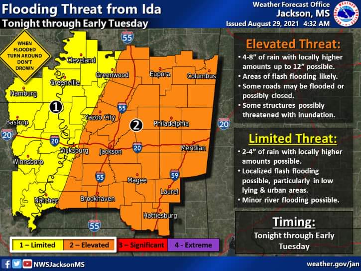
Flash Flood Watch is in effect – Peak Rainfall Amounts: Additional 6-10 inches, with locally higher amounts. Emergency plans should include the potential for major flooding from heavy rain. Evacuations and rescues are likely.
Heed any flood watches and warnings. Failure to take action will likely result in serious injury or loss of life.
POTENTIAL IMPACTS: Extensive – Major rainfall flooding may prompt many evacuations and rescues. – Rivers and tributaries may rapidly overflow their banks in multiple places. Small streams, creeks, canals and ditches may become dangerous rivers. Flood control systems and barriers may become stressed.
Flood waters can enter many structures within multiple communities, some structures becoming uninhabitable or washed away. Many places where flood waters may cover escape routes. Streets and parking lots become rivers of moving water with underpasses submerged. Driving conditions become dangerous. Many road and bridge closures with some weakened or washed out.
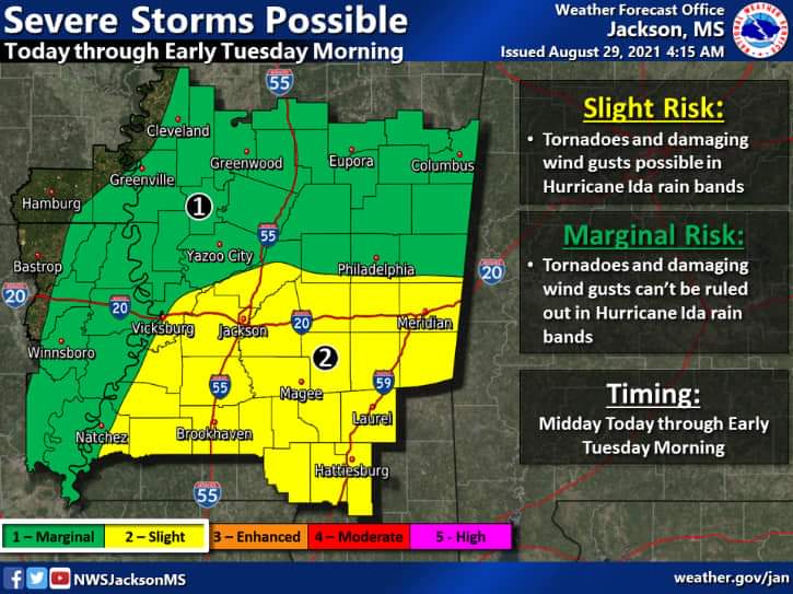
TORNADO – LATEST LOCAL FORECAST:
Emergency plans should include the potential for a few tornadoes. If your shelter is particularly vulnerable to tornadoes, prepare to relocate to safe shelter before hazardous weather arrives. If a tornado warning is issued, be ready to shelter quickly.
Locations could realize roofs peeled off buildings, chimneys toppled, mobile homes pushed off foundations or overturned, large tree tops and branches snapped off, shallow-rooted trees knocked over, moving vehicles blown off roads, and small boats pulled from moorings.
More Galleries


-
Polls
 Loading ...
-
-