NWS Jackson upgrades strong wind warning
Published 10:29 am Tuesday, January 24, 2023
BROOKHAVEN — Strong severe storms are expected to move through Southwest Mississippi from 6 p.m. Tuesday night to 12 a.m. Wednesday morning. NWS Jackson forecasts a slight risk of 60 mph winds, quarter sized hail and the risk of tornadoes.
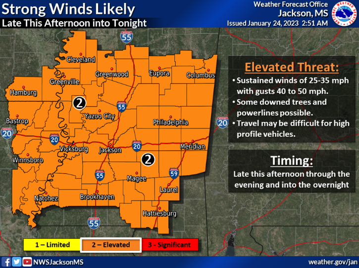
A forecast for strong sustained winds have been upgraded to an elevated threat. Sustained winds are at 25 to 35 mph with wind gusts 40 to 50 mph. Some downed trees are possible and powerlines could be knocked out. We will update you on the amount of power outages in our area this evening.
Travel may be difficult for high profile vehicles. Flash flooding could also pose a threat to vehicles as well. Drivers should not travel through flooded roadways. Your vehicle could be swept off the road and water could washout the roadway beneath the water’s surface.
NWS Jackson warns two to three inches of rainfall are possible in a short time frame. Some roads could become flooded and closed and some structures could become inundated.
Stay weather aware the closer we get to the evening.
More News


-
Polls
 Loading ...
-
-