Severe storms, flooding possible today through Friday
Published 2:00 pm Wednesday, April 5, 2023
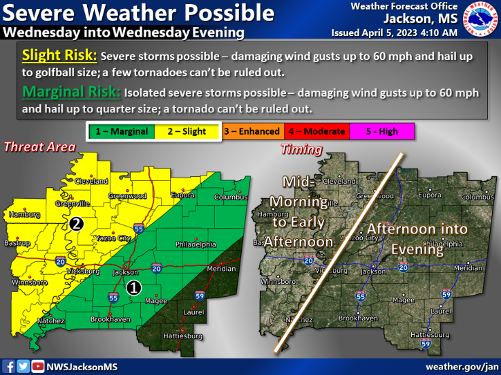
Lincoln County has a marginal risk of isolated severe storms Wednesday afternoon and evening.
According to the National Weather Service in Jackson, the area could experience damaging wind gusts up to 60 mph and hail up to quarter size (1 inch in diameter). A tornado also cannot be ruled out.
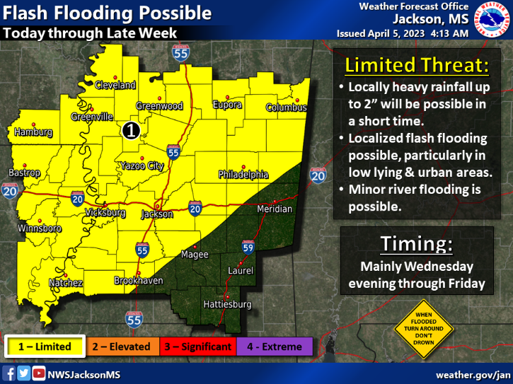
Flash flooding is also possible across most of the county through Friday. The limited threat means heavy rainfall up to 2 inches is possible in a short amount of time.
Flash flooding is possible, particularly in low-lying and urban areas. Minor river flooding is also possible.
Remember the weather maxim, “When flooded, turn around — don’t drown.”
Each year, more deaths occur due to flooding than from any other thunderstorm-related hazard, according to NWS.
The Centers for Disease Control and Prevention report that more than half of all flood-related drownings occur when a vehicle is driven into flood water. The next-highest percentage of flood-related deaths is when people walk near or into the flood waters. People can easily underestimate the force and power of water.
Many of the deaths occur in cars that are swept downstream, and the majority of these deaths are preventable.
Drivers should never drive around barriers blocking a flooded road. The road may have collapsed under the water. Water only 6 inches deep can knock over an adult, and just 12 inches of rushing water can carry away most cars. Two feet of rushing water can carry away trucks and SUVs.
It is never safe to drive or walk into flood waters.
More ZRSS General


-
Polls
 Loading ...
-
-