Lord willing and the creek don’t rise: Flash floods pose threat to Southwest Mississippi
Published 9:39 am Thursday, May 11, 2023
BROOKHAVEN — Lord willing and the creek don’t rise, another round of rain and severe storms is forecast to make its way through Southwest Mississippi today. The National Weather Service in Jackson anticipates the severe storms to arrive in Lincoln County between 3 p.m. to 7 p.m.
Severe storms pose a marginal risk to the area with isolated storms capable of producing damaging wind gusts and quarter size hail. The majority of Lincoln County has anywhere from a 75 percent chance to a 100 percent chance of precipitation today.
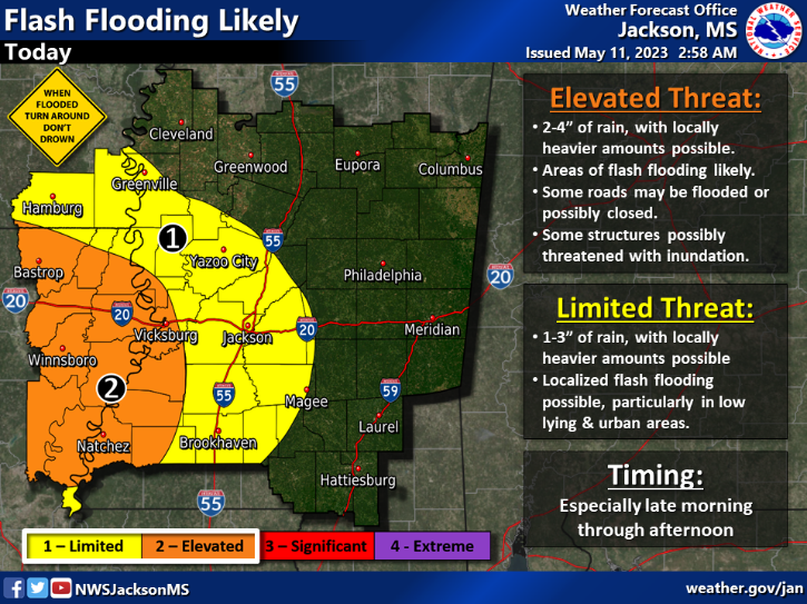
Wind gusts and hail are not the only concern for the area. Flooding is likely for the region according to the National Weather Service. An enhanced threat of flooding is anticipated in Adams, Jefferson, Franklin, Claiborne and Warren Counties and the adjacent parishes in Louisiana.
NWS predicts 2-4 inches of rainfall in a short amount of time with heavier local amounts possible. Roads could be closed and structures could become inundated especially in low lying areas.
A limited threat of flooding is forecast for Lincoln, Copiah and Lawerence Counties. One to three inches of rain could fall in a short amount of time in the limited threat area but localized heavier amounts of rain is always possible. Low lying areas in cow pastures, streets and urban areas could be susceptible to flash flooding.
Rain is not expected to go away. There is at least a 20 percent chance of rain if not greater every day from now until next Thursday.
Stay weather aware and alert throughout today. Check back for updates before, during and after storms arrive.
Please email any pictures, videos or news tips about our weather to hunter.cloud@dailyleader.com.
More News - Main


-
Polls
 Loading ...
-
-