Gordon’s winds to hit Lincoln County between midnight and 3 a.m.
Published 7:47 pm Tuesday, September 4, 2018
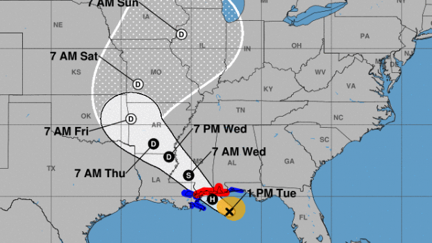
The main wind threat from Tropical Storm Gordon for Lincoln County will arrive between midnight and 3 a.m. Wednesday, Lincoln County Emergency Management Director Clifford Galey said.
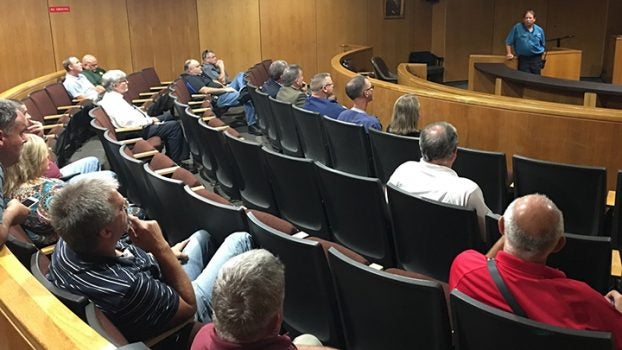
Galey on Tuesday met with school superintendents, first responders, King’s Daughter Medical Center officials and city officials in the upstairs courtroom of the Lincoln County-Brookhaven Government Complex.
Gordon was expected to grow to a Category 1 hurricane by the time it hit land, but downgrade back down to a tropical storm by the time it comes to Lincoln County, he said.
MEMA had not requested the shelter at the Brookhaven Building to be opened.
Galey said he was expecting 30-40 mph winds in the Lincoln County area. There was a flash flood watch, with an expected 3 to 6 inches of rain here starting Tuesday night and into Wednesday. If Gordon’s storm bands parked over Lincoln County, residents could expect heavier rainfall totals, he said.
Power outages will be a concern.
Area school are closed Wednesday.
“We’re going to err on the side of being over-cautious,” said Lincoln County Superintendent Mickey Myers.
Galey says sirens in Brookhaven would only be sounded if a tornado warning is issued for the city.
In Jackson, Gov. Phil Bryant signed a State of Emergency and an Executive Order authorizing the use of the Mississippi National Guard as Tropical Storm Gordon advances to the Gulf of Mexico.
The National Guard had personnel in pre-positioned in the lower six counties of Mississippi.
The State Emergency Operations Center was activated to Level 3 (partial with key state agencies) on Monday afternoon and moved to a full Level 2 activation at 7 a.m. Tuesday morning. The State Emergency Operations Center was to run 24-hour operations, as long as necessary.
“Gordon will bring heavy rainfall and life-threatening storm surge to our coast, along with flash flooding and isolated tornadoes further north,” Bryant said. “All residents must take this storm seriously and act on the expertise of your local officials.”


