New MDOT site shows road and bridge data
Published 8:30 pm Wednesday, January 30, 2019

- MDOT PATH screenshot
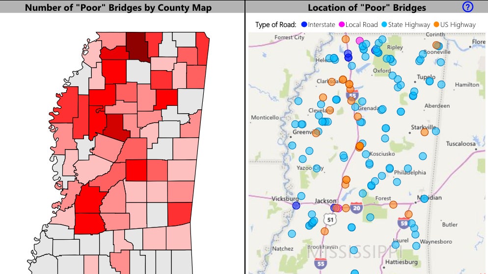
A new Mississippi Department of Transportation data website can tell county residents something they already know — some state maintained roads are in lousy shape.
The new website, MDOT Public Accountability Transportation Hub or PATH, provides an interactive visual analysis of historical and current statewide road and bridge conditions.
Currently, the MDOT PATH site offers data on the condition of all bridges on the state-owned transportation system, as well as pavement conditions for all state-maintained highways and interstates. In the future, MDOT will add a component to allow the public to view active construction projects throughout the state.
“The data presented on this new website isn’t new, MDOT has always made the data available,” said Melinda McGrath, MDOT executive director. “The website presents the data in a new, more user-friendly way.”
The site’s data shows that Lincoln County’s state-maintained roads were last in “good” condition overall in 2008. Since then it’s been downhill to almost “poor” in 2016, the most recent data available.
The scale is based on something called “Average Pavement Condition Rating.” A rating of 72 is poor and 82 is good. Local state roads scored an average of 74.5 in 2016.
State roads in the county include Hwys. 51, 84, 550, 583, 569, 98 and I-55, among others. Recent paving projects, like the one on 550, are not factored into the available data.
MDOT inspects state roads every two years, meaning the last inspection was in 2018. That data is not yet available on the website.
Overall, the state’s interstate highway system rated “good” while its two-lane, non-interstate highways were close to “poor.”
The website also includes information on state bridges, with most of those in Lincoln County scoring “good.” About 25 bridges scored “fair.”
Funding for road and bridge needs has been a contentious issue for the Legislature annually.


