More severe weather likely tonight through Wednesday
Published 12:35 pm Monday, April 4, 2022
A strong storm system is expected to move through Lincoln County tonight and into Tuesday.
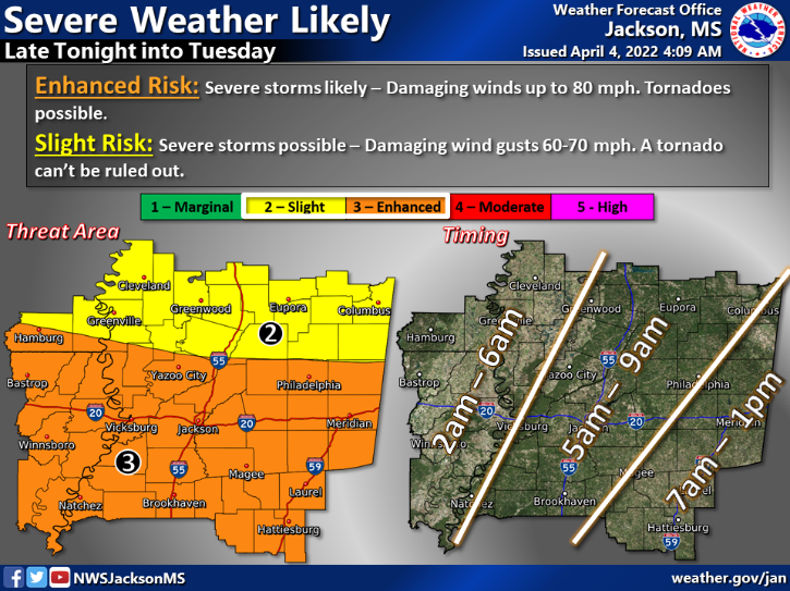
The enhanced threat area covers much of South and Central Mississippi. Severe storms are likely — an 80 percent chance, with damaging winds up to 80 mph. Tornados are also possible.
The worst of the weather is expected to move through Lincoln County and nearby areas between 5 a.m. and 9 a.m. Tuesday morning.
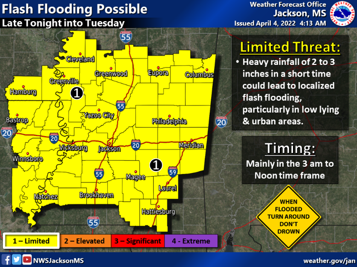
A limited threat of flash flooding also exists. Heavy rainfall of 2-3 inches in a short time period could lead to localized flash flooding, particularly in low-lying and urban areas. Flooding has the potential to occur mainly from 3 a.m. to noon Tuesday.
A slight risk remains for severe storms on Wednesday, as well. This threat is primarily for the afternoon as a cold front moves through the area.
The Mississippi Emergency Management Agency encourages residents to monitor forecasts; have tornado alerts turned up loud; identify a safe place to go in case of a tornado; have a disaster kit with at least 72 hours’ worth of non-perishable food and water; and prepare for prolonged power outages.
More Galleries


SportsPlus
How to Watch MLB Baseball on Friday, July 26: TV Channel, Live Streaming, Start Times
The Cleveland Guardians and the Philadelphia Phillies hit the field in one of many exciting matchups on the…
How to Watch the Braves vs. Mets Game: Streaming & TV Channel Info for July 26
Charlie Morton will start for the Atlanta Braves in the second of a four-game series against the New…
Braves vs. Mets: Betting Preview for July 26
Francisco Lindor will lead the way for the New York Mets (54-48) on Friday, July 26, when they…
New Orleans Saints vs. Las Vegas Raiders Week 17 Tickets Available – Sunday, December 29 at Caesars Superdome
On Sunday, December 29, 2024, the Las Vegas Raiders (0-0) challenge the New Orleans Saints (0-0) at Caesars…
New Orleans Saints vs. Atlanta Falcons Week 10 Tickets Available – Sunday, November 10 at Caesars Superdome
A couple of NFC South rivals clash on Sunday, November 10, 2024 at Caesars Superdome when the New…
-
Polls
 Loading ...
-
-