Hurricane season predicted to be a busy one
Published 3:02 pm Thursday, May 23, 2024
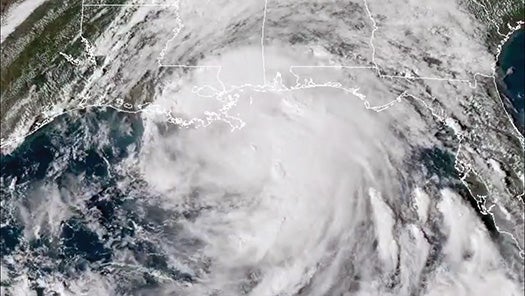
- Photo courtesy of NOAA Hurricane Nate, pictured as it approached the Coast in October 2018, was the Gulf’s fastest-moving storm on record.
WASHINGTON D.C. — Scientists with the North American Oceanic and Atmospheric Administration predict above-normal hurricane activity in the Atlantic this year. Forecasters with the National Weather Service and Climate Prediction Center worked on the outlook.
The 2024 Atlantic Hurricane season spans from June 1 to November 30. Experts predict an 85 percent chance for an above-normal season, a 10 percent chance of a near-normal season and a 5 percent chance of a below-normal season.
Brookhaven is not completely safe from hurricanes. Tornadoes, strong winds and heavy rainfall associated with hurricanes and tropical storms can be a threat in southwest Mississippi.
NOAA forecasts a range of 17 to 25 total named storms, those with winds of 39 mph or higher. Of those, 8 to 13 are forecast to become hurricanes, those with winds of 74 mph or higher, including 4 to 7 major hurricanes, with winds of 111 mph or higher. Forecasters have a 70 percent confidence in these ranges according to an NOAA press release.
An average hurricane season has 14 named storms with seven hurricanes and three major hurricanes. In 2023, the Atlantic ocean saw 20 named storms, fourth most since 1950, seven of those storms were hurricanes and three became major hurricanes.
Only one of those hurricanes made landfall. Hurricane Idalia made landfall on Aug. 30 near Keaton Beach Florida as a Category 3 Hurricane.
According to NOAA records, the record breaking 2005 season had 27 named storms, 14 were hurricanes, eight major hurricanes formed including Hurricane Katrina. 2020 set a hurricane season record with 30 named storms, 14 hurricanes and seven major hurricanes.
Fuel for storms
According to the NOAA, the Hurricane outlook is expected to have above normal activity due to a few factors. The Atlantic basin has near-record warm ocean temperatures in the Atlantic Ocean, there is development of La Nina conditions in the Pacific, reduced Atlantic trade winds and less wind shear all tend to favor tropical storm formation.
Oceanic heat in the tropical Atlantic Ocean and Caribbean Sea creates more energy for storm development.
NOAA Administrator Rick Spinrad said in a press release they will use technology to aid in protecting the public. A new NOAA mapping of flood inundation will provide information for emergency and water managers to prepare and respond to potential flooding.
“With another active hurricane season approaching, NOAA’s commitment to keeping every American informed with life saving information is unwavering,” Spinrad said. “AI-enabled language translations and a new depiction of inland wind threats in the forecast cone are just two examples of the proactive steps our agency is taking to meet our mission of saving lives and protecting property.”
Federal Emergency Management Agency Deputy Administrator Erik A. Hooks said in a press release severe weather and subsequent emergencies can happen at any moment. Individuals and communities need to be prepared for weather threats.
“Already, we are seeing storms move across the country that can bring additional hazards like tornadoes, flooding and hail,” Hooks said. “Taking a proactive approach to our increasingly challenging climate landscape today can make a difference in how people can recover tomorrow.”
More News


SportsPlus
Braves vs. Mets: Betting Preview for July 27
On Saturday, July 27 at 4:10 PM ET, the New York Mets (55-48) host the Atlanta Braves (54-48)…
How to Watch MLB Baseball on Saturday, July 27: TV Channel, Live Streaming, Start Times
The Cleveland Guardians versus the Philadelphia Phillies is one of many strong options on today’s MLB schedule. Wager…
How to Watch the Braves vs. Mets Game: Streaming & TV Channel Info for July 27
Austin Riley and the Atlanta Braves will hit the field against the New York Mets and starter Tylor…
How to Watch MLB Baseball on Friday, July 26: TV Channel, Live Streaming, Start Times
The Cleveland Guardians and the Philadelphia Phillies hit the field in one of many exciting matchups on the…
How to Watch the Braves vs. Mets Game: Streaming & TV Channel Info for July 26
Charlie Morton will start for the Atlanta Braves in the second of a four-game series against the New…
-
Polls
 Loading ...
-
-