Heavy rains, storms, tornadoes expected this week
Published 8:42 am Monday, March 15, 2021
Thunderstorms and heavy rains are expected across the majority of the state today as meteorologists urge residents from the Southeast coast to the southern Plains to remain weather aware throughout the week.
The weather pattern moving into the area could lead to a multi-day outbreak of severe weather, including tornadoes, AccuWeather meteorologists said Monday morning. The main threat across the Southeast will be areas of downpours that can slow travel and lead to isolated incidents of flash flooding. A few gusty thunderstorms are also possible.
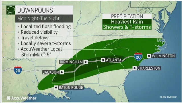
Tuesday, the storm is expected to stall out over the Southern states, leading to rounds of downpours stretching from Louisiana to the Carolinas throughout the day. A few storms can become heavy and gusty and flash flooding will be possible where the heaviest rain persists.
The heaviest rains are expected to fall in a band from Southwest Mississippi — including Lincoln County — across Alabama and Georgia and into South Carolina. In these areas, rainfall can reach up to 5 inches from Monday night through Tuesday night.
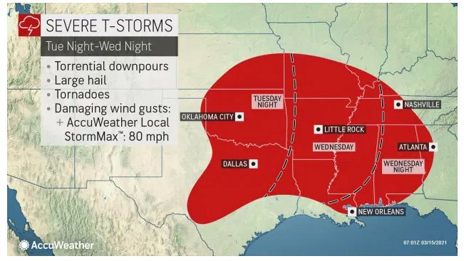
From Tuesday night through Wednesday night, severe thunderstorms are expected to hit the area. All of Mississippi is under the watch area, as well all of Arkansas and the majority of Louisiana, Alabama and Oklahoma, with portions of surrounding states affected.
Torrential downpours, large hail, tornadoes and damaging wind gusts up to 80 mph are forecast during this time.
“In the Southeast U.S., nighttime tornadoes are more common than in any other region of the U.S.,” said AccuWeather senior meteorologist Mike Doll.


